Geolocate

Powayan topographic map

Click on the map to display elevation.

About this map

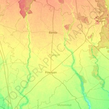
Name: Powayan topographic map, elevation, terrain.

Location: Powayan, Shahjahanpur, Uttar Pradesh, India (27.90706 79.89249 28.38106 80.35769)

Average elevation: 163 m

Minimum elevation: 143 m

Maximum elevation: 185 m

Gear up for your next adventure:

🖼️Topographic Map Art - Decorative 3D-effect posters of famous UK peaks and regions
👖Hiking Trousers - Durable trousers designed for rough terrain
🛌Sleeping Mats - Insulated mats for comfortable outdoor sleeping
🧷Tenacious Repair Tape - Instant fix for torn tents, jackets, or dry bags
🌂Windproof Trekking Umbrellas - Surprising but effective rain protection on low-wind trails

As an Amazon Associate, this site earns from qualifying purchases at no extra cost to you.