Geolocate

Cefn topographic map

Click on the map to display elevation.

About this map

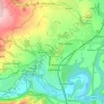
Name: Cefn topographic map, elevation, terrain.

Location: Cefn, Acrefair, Wrexham, Wales, United Kingdom (52.96251 -3.12739 52.99861 -3.05521)

Average elevation: 142 m

Minimum elevation: 46 m

Maximum elevation: 327 m

Wrexham trails, hiking, mountain biking, running and outdoor activities

Gear up for your next adventure:

📷Outdoor Action Cameras - Cameras designed for hiking and adventure
📱Rugged Phone Cases - Heavy-duty protection for smartphones used as secondary GPS tools
🐕Hiking Dog Harnesses - Rugged harnesses for taking your companion on mountain trails
🧢Waterproof Hiking Hats - Keep the rain off your face while studying topographic maps
🛰️Handheld GPS Devices - Reliable GPS units for hiking and outdoor navigation

As an Amazon Associate, this site earns from qualifying purchases at no extra cost to you.