
Wulong District topographic map
Interactive map
Click on the map to display elevation.
About this map
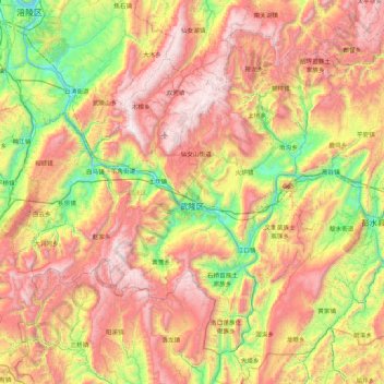
Name: Wulong District topographic map, elevation, terrain.
Location: Wulong District, 渝东南武陵山区城镇群区位, Chongqing, China (29.03732 107.22227 29.67100 108.08111)
Average elevation: 980 m
Minimum elevation: 135 m
Maximum elevation: 1,990 m
Other topographic maps
Click on a map to view its topography, its elevation and its terrain.
Tudi
China > Chongqing > Wulong District
Tudi, Wulong District, Chongqing, China
Average elevation: 1,054 m