
Songtan topographic map
Interactive map
Click on the map to display elevation.
About this map
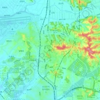
Name: Songtan topographic map, elevation, terrain.
Location: Songtan, Pyeongtaek-si, Gyeonggi-do, 17774, South Korea (37.02707 127.02443 37.10707 127.10443)
Average elevation: 34 m
Minimum elevation: 5 m
Maximum elevation: 149 m