
Thazi Township topographic map
Interactive map
Click on the map to display elevation.
About this map
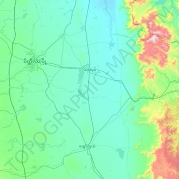
Name: Thazi Township topographic map, elevation, terrain.
Location: Thazi Township, Meiktila District, Mandalay, Myanmar (20.50656 95.92987 21.05675 96.57554)
Average elevation: 291 m
Minimum elevation: 123 m
Maximum elevation: 1,322 m