
Jagua topographic map
Interactive map
Click on the map to display elevation.
About this map
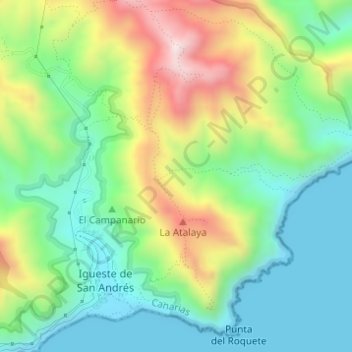
Name: Jagua topographic map, elevation, terrain.
Location: Jagua, Santa Cruz de Tenerife, Canarias, 38129, España (28.53267 -16.14930 28.53437 -16.14691)
Average elevation: 187 m
Minimum elevation: 0 m
Maximum elevation: 535 m
Other topographic maps
Click on a map to view its topography, its elevation and its terrain.
Santa Cruz de Tenerife
España > Canarias > Santa Cruz de Tenerife
Santa Cruz de Tenerife, Canarias, España
Average elevation: 242 m