
Make a donation
Gear up for your next adventure:
As an Amazon Associate, this site earns from qualifying purchases at no extra cost to you.
Ravels topographic map
Click on the map to display elevation.
Make a donation
Gear up for your next adventure:
As an Amazon Associate, this site earns from qualifying purchases at no extra cost to you.
Ravels
Omstreeks 1850 begon de ontginning van de uitgestrekte woeste gronden in de omgeving van Ravels. Rond deze tijd werd ook het Kanaal Dessel-Turnhout-Schoten gegraven, waarbij men kleilagen aantrof die interessant bleken voor de baksteenindustrie. Omstreeks 1900 werden er meerdere baksteen- en cementfabrieken opgericht. Deze groepeerden zich uiteindelijk in de Cimenteries et Briqueteries Réunies (C.B.R.). De cementfabrieken bereikten hun hoogtepunt omstreeks 1925, maar sloten in 1944.
Make a donation
Gear up for your next adventure:
As an Amazon Associate, this site earns from qualifying purchases at no extra cost to you.
About this map
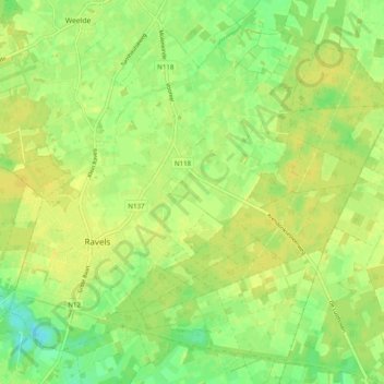
Name: Ravels topographic map, elevation, terrain.
Location: Ravels, Turnhout, Antwerpen, Vlaanderen, 2380, België (51.35273 4.97215 51.40685 5.07118)
Average elevation: 30 m
Minimum elevation: 18 m
Maximum elevation: 36 m
Make a donation
Gear up for your next adventure:
As an Amazon Associate, this site earns from qualifying purchases at no extra cost to you.
Other topographic maps
Click on a map to view its topography, its elevation and its terrain.