Geolocate

Newton topographic map

Click on the map to display elevation.

About this map

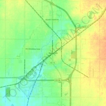
Name: Newton topographic map, elevation, terrain.

Location: Newton, Harvey County, Kansas, 67114, United States (38.00692 -97.38472 38.08692 -97.30472)

Average elevation: 444 m

Minimum elevation: 427 m

Maximum elevation: 463 m

Gear up for your next adventure:

Lightweight Tents - Compact tents for backpacking and trekking
🌦️Portable Weather Meters - Handheld tools for monitoring weather conditions
🥾Walking Shoes - Lightweight walking shoes for countryside and coastal paths
🧣Fleece Neck Warmers - Extra insulation for winter topographic surveys
🥫Expedition Meals - Lightweight, high-calorie nutrition for long-distance hikers

As an Amazon Associate, this site earns from qualifying purchases at no extra cost to you.