
Thank you for supporting this site ❤️
Make a donation
Make a donation
Gear up for your next adventure:
As an Amazon Associate, this site earns from qualifying purchases at no extra cost to you.
Chinchaycocha topographic map
Click on the map to display elevation.
Thank you for supporting this site ❤️
Make a donation
Make a donation
Gear up for your next adventure:
As an Amazon Associate, this site earns from qualifying purchases at no extra cost to you.
About this map
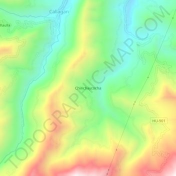
Name: Chinchaycocha topographic map, elevation, terrain.
Location: Chinchaycocha, Molino, Provincia de Pachitea, Huánuco, Perú (-10.00118 -76.06254 -9.96118 -76.02254)
Average elevation: 2,853 m
Minimum elevation: 2,496 m
Maximum elevation: 3,400 m
Thank you for supporting this site ❤️
Make a donation
Make a donation
Gear up for your next adventure:
As an Amazon Associate, this site earns from qualifying purchases at no extra cost to you.