Geolocate

Mead topographic map

Click on the map to display elevation.

About this map

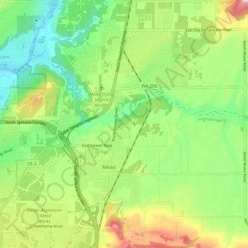
Name: Mead topographic map, elevation, terrain.

Location: Mead, Spokane County, Washington, 99021, United States (47.74704 -117.37824 47.80945 -117.32518)

Average elevation: 575 m

Minimum elevation: 488 m

Maximum elevation: 720 m

Gear up for your next adventure:

🧼Technical Clothing Wash - Special soap to clean and restore waterproof membranes
🦶Anti-Blister Balms - Protect your feet before long topographic expeditions
📢Survival Whistles - Essential safety gear for signaling for help in mountain fog
🎒Hiking Daypacks (20L) - Compact backpacks for day trips and technical mountain ascents
🎒Multi-day Trekking Packs - Large capacity backpacks for wild camping and long-distance trails

As an Amazon Associate, this site earns from qualifying purchases at no extra cost to you.