Geolocate

Goby topographic map

Click on the map to display elevation.

About this map

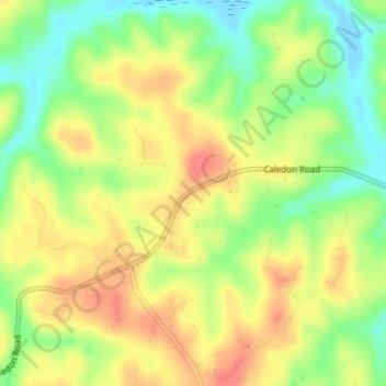
Name: Goby topographic map, elevation, terrain.

Location: Goby, King George County, Virginia, United States (38.30374 -77.28415 38.32374 -77.26415)

Average elevation: 33 m

Minimum elevation: -4 m

Maximum elevation: 61 m

Other topographic maps

Click on a map to view its topography, its elevation and its terrain.

Gear up for your next adventure:

🧥Packable Down Jackets - Lightweight warmth that compresses small in your bag
🔋Solar Power Banks - Keep your GPS and phone charged during multi-day expeditions
🚲Cycling GPS Computers - Track elevation and topographic routes on two wheels
🧼Biodegradable Soap - Leave-no-trace hygiene for multi-day mountain treks
👖Packable Overtrousers - Quick-deploy rain protection for legs in sudden storms

As an Amazon Associate, this site earns from qualifying purchases at no extra cost to you.