
Make a donation
Gear up for your next adventure:
As an Amazon Associate, this site earns from qualifying purchases at no extra cost to you.
Tête du Géant topographic map
Click on the map to display elevation.
Make a donation
Gear up for your next adventure:
As an Amazon Associate, this site earns from qualifying purchases at no extra cost to you.
Tête du Géant
La tête du Géant est une montagne située à la limite de la Haute-Savoie et du canton suisse du Valais, dans le massif du Chablais. Elle culmine à 2 228 ou 2 232 mètres d'altitude et se trouve entre le val d'Abondance et le Chablais valaisan.
Make a donation
Gear up for your next adventure:
As an Amazon Associate, this site earns from qualifying purchases at no extra cost to you.
About this map
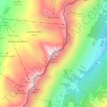
Name: Tête du Géant topographic map, elevation, terrain.
Average elevation: 1,813 m
Minimum elevation: 1,427 m
Maximum elevation: 2,205 m
Make a donation
Gear up for your next adventure:
As an Amazon Associate, this site earns from qualifying purchases at no extra cost to you.