
Fraijanes topographic map
Interactive map
Click on the map to display elevation.
About this map
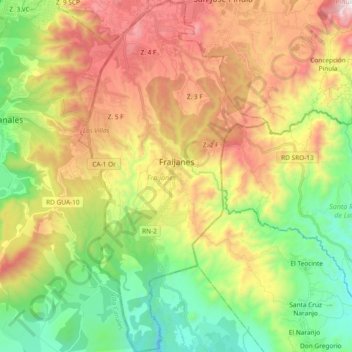
Name: Fraijanes topographic map, elevation, terrain.
Location: Fraijanes, Guatemala (14.36375 -90.49086 14.54456 -90.39080)
Average elevation: 1,491 m
Minimum elevation: 984 m
Maximum elevation: 2,042 m
Other topographic maps
Click on a map to view its topography, its elevation and its terrain.