Geolocate

Linkou topographic map

Click on the map to display elevation.

About this map

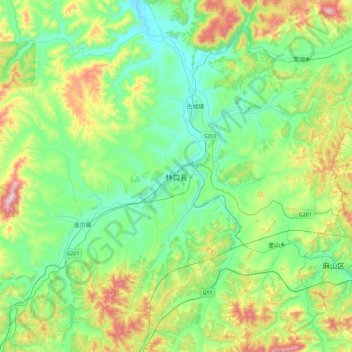
Name: Linkou topographic map, elevation, terrain.

Location: Linkou, Linkou County, Mudanjiang City, Heilongjiang, China (45.13007 130.10698 45.45007 130.42698)

Average elevation: 362 m

Minimum elevation: 219 m

Maximum elevation: 744 m

Gear up for your next adventure:

🍲Portable Camping Stoves - Fast-boiling stoves for hot meals on remote topographic survey trips
🔦Waterproof LED Headlamps - Hands-free lighting for evening treks and emergency navigation
Insulated Travel Mugs - Keep drinks hot while surveying the landscape from a summit
🕶️Polarized Sunglasses - Reduces glare from snow and water when reading terrain
🛑Emergency Bivvy Bags - Heat-reflective survival bags for unexpected nights out

As an Amazon Associate, this site earns from qualifying purchases at no extra cost to you.