Geolocate

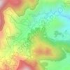
Pico topographic map

Click on the map to display elevation.

About this map

Name: Pico topographic map, elevation, terrain.

Location: Pico, Kiangan, Ifugao, Cordillera Administrative Region, 3604, Philippines (16.75525 121.06712 16.79525 121.10712)

Average elevation: 808 m

Minimum elevation: 436 m

Maximum elevation: 1,318 m

Other topographic maps

Click on a map to view its topography, its elevation and its terrain.
Bilong

Philippines > Ifugao > Kiangan

Average elevation: 983 m

Bilong

Philippines > Ifugao > Kiangan

Average elevation: 983 m

Gear up for your next adventure:

🧭GPS Trackers - Tracking devices for safety and navigation
⛺Lightweight Solo Tents - Backpacking tents designed for wild camping in the UK highlands
⛺Lightweight Tents - Compact tents for backpacking and trekking
📍Handheld GPS Navigators - Reliable satellite navigation for hiking and off-road exploration
🔋Solar Chargers - Eco-friendly charging solutions for outdoor use

As an Amazon Associate, this site earns from qualifying purchases at no extra cost to you.