
Tvishi topographic map
Interactive map
Click on the map to display elevation.
About this map
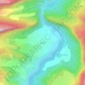
Name: Tvishi topographic map, elevation, terrain.
Average elevation: 626 m
Minimum elevation: 305 m
Maximum elevation: 1,282 m
Other topographic maps
Click on a map to view its topography, its elevation and its terrain.
Orbeli
Georgia > Racha-Lechkhumi and Lower Svaneti > Tsageri Municipality > Orbeli
Average elevation: 737 m