
Speikern topographic map
Interactive map
Click on the map to display elevation.
About this map
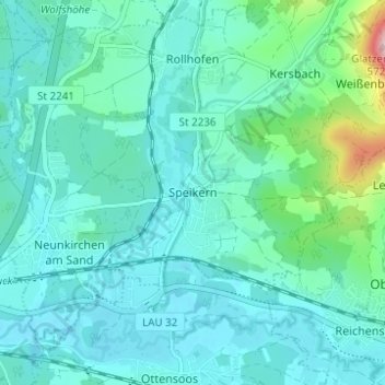
Name: Speikern topographic map, elevation, terrain.
Average elevation: 354 m
Minimum elevation: 319 m
Maximum elevation: 542 m
Eichig | Kersbach | Neunkirchen am Sand | Rollhofen | Speikern | Weißenbach | Wolfshöhe