Geolocate

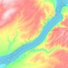
Kirkpatrick topographic map

Click on the map to display elevation.

About this map

Name: Kirkpatrick topographic map, elevation, terrain.

Location: Kirkpatrick, Umatilla County, Oregon, United States (45.66606 -118.68472 45.69025 -118.62031)

Average elevation: 421 m

Minimum elevation: 369 m

Maximum elevation: 467 m

Other topographic maps

Click on a map to view its topography, its elevation and its terrain.

Meacham

United States > Oregon > Umatilla County

Average elevation: 1,166 m

Tollgate

United States > Oregon > Umatilla County

Average elevation: 1,512 m

Myrick

United States > Oregon > Umatilla County

Average elevation: 535 m

Cabbage Hill

United States > Oregon > Umatilla County

Average elevation: 1,015 m

Hinkle

United States > Oregon > Umatilla County

Average elevation: 178 m

Wallula Gap

United States > Oregon > Umatilla County

Average elevation: 313 m

Nolin

United States > Oregon > Umatilla County

Average elevation: 295 m

Gear up for your next adventure:

🧣Neck Gaiters - Versatile protection against wind and cold
👖Packable Overtrousers - Quick-deploy rain protection for legs in sudden storms
🌦️Portable Weather Meters - Handheld tools for monitoring weather conditions
👟Heavy Duty Boot Laces - Always carry a spare for your hiking footwear
🔥Reusable Hand Warmers - Maintain dexterity in your fingers for precise map handling

As an Amazon Associate, this site earns from qualifying purchases at no extra cost to you.