Geolocate

Kitengela topographic map

Click on the map to display elevation.

About this map

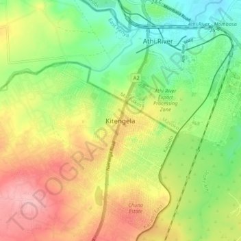
Name: Kitengela topographic map, elevation, terrain.

Location: Kitengela, Kitengela ward, Kajiado East, Kajiado County, Rift Valley, Kenya (-1.51456 36.91907 -1.43456 36.99907)

Average elevation: 1,554 m

Minimum elevation: 1,494 m

Maximum elevation: 1,627 m

Gear up for your next adventure:

📦Compression Sacks - Reduce backpack volume efficiently
👟Waterproof Leg Gaiters - Keep mud and water out of your boots in boggy terrain
👖Hiking Trousers - Durable trousers designed for rough terrain
🔦Head Torches - Hands-free lighting for hiking and camping
🌦️Portable Weather Meters - Handheld tools for monitoring weather conditions

As an Amazon Associate, this site earns from qualifying purchases at no extra cost to you.