
Shirvan topographic map
Click on the map to display elevation.
About this map
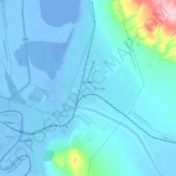
Name: Shirvan topographic map, elevation, terrain.
Location: Shirvan, Shirvan District, Shirvan-Salyan, Azerbaijan (39.90947 48.88522 39.99421 48.97853)
Average elevation: 16 m
Minimum elevation: -25 m
Maximum elevation: 251 m
Other topographic maps
Click on a map to view its topography, its elevation and its terrain.
Shirvan District
Throughout its history, Shirvan has suffered from floods because of its proximity to the river and the relatively low elevation of most of the town.
Average elevation: 13 m