
Llagostera topographic map
Interactive map
Click on the map to display elevation.
About this map
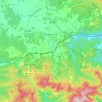
Name: Llagostera topographic map, elevation, terrain.
Location: Llagostera, Gironés, Gerona, Cataluña, 17240, España (41.75754 2.84968 41.86502 2.97076)
Average elevation: 184 m
Minimum elevation: 47 m
Maximum elevation: 498 m