
水竹洼 topographic map
Interactive map
Click on the map to display elevation.
About this map
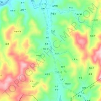
Name: 水竹洼 topographic map, elevation, terrain.
Location: 水竹洼, 王楼村, 新县, 平桥区, 信阳市, 河南省, 中国 (31.48056 114.90570 31.52056 114.94570)
Average elevation: 231 m
Minimum elevation: 125 m
Maximum elevation: 371 m