
San Bernardo topographic map
Interactive map
Click on the map to display elevation.
About this map
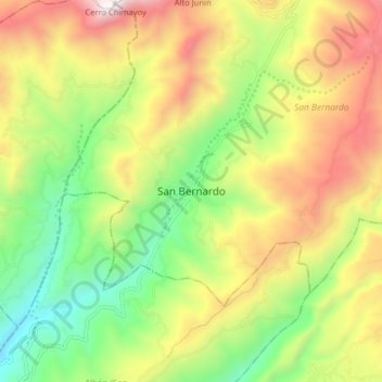
Name: San Bernardo topographic map, elevation, terrain.
Location: San Bernardo, Rio Mayo, Nariño, Colombia (1.47588 -77.08577 1.55588 -77.00577)
Average elevation: 2,273 m
Minimum elevation: 1,612 m
Maximum elevation: 3,111 m