
Thank you for supporting this site ❤️
Make a donation
Make a donation
Gear up for your next adventure:
As an Amazon Associate, this site earns from qualifying purchases at no extra cost to you.
Křinec topographic map
Click on the map to display elevation.
Thank you for supporting this site ❤️
Make a donation
Make a donation
Gear up for your next adventure:
As an Amazon Associate, this site earns from qualifying purchases at no extra cost to you.
About this map
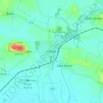
Name: Křinec topographic map, elevation, terrain.
Location: Křinec, okres Nymburk, Central Bohemia, 289 33, Czechia (50.24591 15.11944 50.28591 15.15944)
Average elevation: 198 m
Minimum elevation: 188 m
Maximum elevation: 247 m
Thank you for supporting this site ❤️
Make a donation
Make a donation
Gear up for your next adventure:
As an Amazon Associate, this site earns from qualifying purchases at no extra cost to you.