
Hill City topographic map
Interactive map
Click on the map to display elevation.
About this map
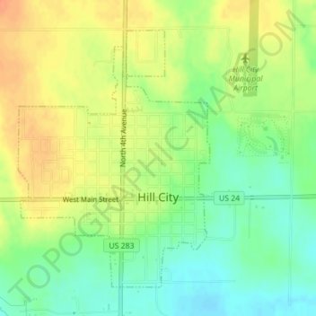
Name: Hill City topographic map, elevation, terrain.
Location: Hill City, Graham County, Kansas, 67642, United States (39.35701 -99.85754 39.37898 -99.83636)
Average elevation: 666 m
Minimum elevation: 645 m
Maximum elevation: 686 m
Other topographic maps
Click on a map to view its topography, its elevation and its terrain.
Morland
United States > Kansas > Graham County
Morland, Graham County, Kansas, 67650, United States
Average elevation: 715 m