
Shady Lake topographic map
Interactive map
Click on the map to display elevation.
About this map
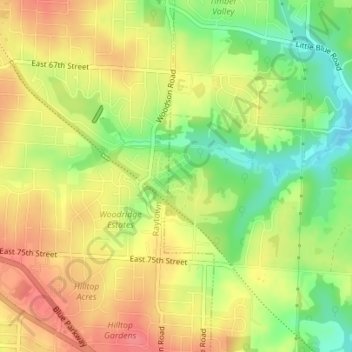
Name: Shady Lake topographic map, elevation, terrain.
Location: Shady Lake, Raytown, Jackson County, Missouri, United States (38.99195 -94.44574 38.99319 -94.44275)
Average elevation: 279 m
Minimum elevation: 242 m
Maximum elevation: 308 m
Other topographic maps
Click on a map to view its topography, its elevation and its terrain.
Raytown
United States > Missouri > Jackson County > Raytown
Raytown, Jackson County, Missouri, 64133, United States
Average elevation: 274 m