Geolocate

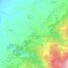
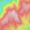
Arcozelo topographic map

Click on the map to display elevation.

About this map

Name: Arcozelo topographic map, elevation, terrain.

Location: Arcozelo, Gouveia, Guarda, 6290-051, Portugal (40.51525 -7.66363 40.56804 -7.57715)

Average elevation: 408 m

Minimum elevation: 258 m

Maximum elevation: 574 m

Other topographic maps

Click on a map to view its topography, its elevation and its terrain.
Serra do Boi

Portugal > Guarda > Gouveia

Average elevation: 1,130 m

Moimenta da Serra

Portugal > Guarda > Gouveia

Average elevation: 592 m

Nespereira

Portugal > Guarda > Gouveia

Average elevation: 504 m

Melo

Portugal > Guarda > Gouveia

Average elevation: 665 m

Figueiró da Serra

Portugal > Guarda > Gouveia

Average elevation: 628 m

Vinhó

Portugal > Guarda > Gouveia

Average elevation: 528 m

Freixo da Serra

Portugal > Guarda > Gouveia

Average elevation: 659 m

Mangualde da Serra

Portugal > Guarda > Gouveia

Average elevation: 691 m

Nabais

Portugal > Guarda > Gouveia

Average elevation: 599 m

Cabeça do Faraó

Portugal > Guarda > Gouveia > Folgosinho

Average elevation: 1,173 m

Tazem

Portugal > Guarda > Gouveia > Vila Nova de Tazem

Average elevation: 442 m

Freixo da Serra

Portugal > Guarda > Gouveia

Average elevation: 659 m

Gear up for your next adventure:

🥤Hydration Bladders - Hands-free hydration systems for backpacks
🧦Hiking Socks - Breathable socks designed to prevent blisters on long walks
🐕Dog Hiking Gear - Equipment for hiking safely with dogs
📱Phone Mounts for Hiking - Secure mounts to carry your phone on trails
👖Hiking Trousers - Durable trousers designed for rough terrain

As an Amazon Associate, this site earns from qualifying purchases at no extra cost to you.