Geolocate

Colville topographic map

Click on the map to display elevation.

About this map

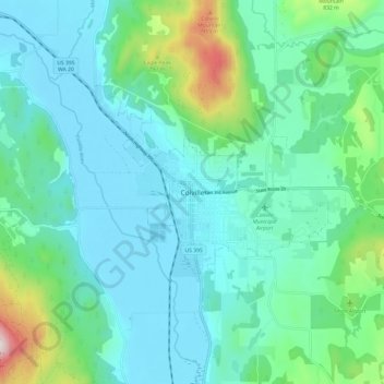
Name: Colville topographic map, elevation, terrain.

Location: Colville, Stevens County, Washington, United States (48.50657 -117.94554 48.58657 -117.86554)

Average elevation: 602 m

Minimum elevation: 468 m

Maximum elevation: 1,181 m

Gear up for your next adventure:

🥾Trekking Poles - Poles to improve stability on uneven terrain
🥾Hiking Boots - Waterproof and durable boots for long-distance hiking in the UK
📱Phone Mounts for Hiking - Secure mounts to carry your phone on trails
🧭GPS Trackers - Tracking devices for safety and navigation
🧣Fleece Neck Warmers - Extra insulation for winter topographic surveys

As an Amazon Associate, this site earns from qualifying purchases at no extra cost to you.