Geolocate

Salve topographic map

Click on the map to display elevation.

About this map

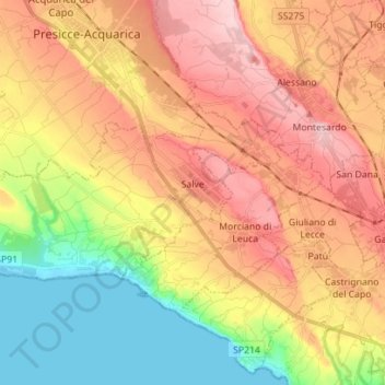
Name: Salve topographic map, elevation, terrain.

Location: Salve, Lecce, Apulia, Italy (39.83429 18.18667 39.88363 18.32651)

Average elevation: 96 m

Minimum elevation: -2 m

Maximum elevation: 185 m

Gear up for your next adventure:

📦Compression Sacks - Reduce backpack volume efficiently
🧤Waterproof Overmitts - Extreme weather protection for hikers and mountaineers
🥾Hiking Boots - Waterproof and durable boots for long-distance hiking in the UK
📐Altimeters & Barometers - Tools for measuring altitude and air pressure
👟Waterproof Leg Gaiters - Keep mud and water out of your boots in boggy terrain

As an Amazon Associate, this site earns from qualifying purchases at no extra cost to you.