
Thank you for supporting this site ❤️
Make a donation
Make a donation
Gear up for your next adventure:
As an Amazon Associate, this site earns from qualifying purchases at no extra cost to you.
Pedrola topographic map
Click on the map to display elevation.
Thank you for supporting this site ❤️
Make a donation
Make a donation
Gear up for your next adventure:
As an Amazon Associate, this site earns from qualifying purchases at no extra cost to you.
About this map
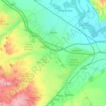
Name: Pedrola topographic map, elevation, terrain.
Location: Pedrola, Ribera Alta del Ebro, Zaragoza, Aragon, 50690, Spain (41.70706 -1.34790 41.81866 -1.17652)
Average elevation: 273 m
Minimum elevation: 212 m
Maximum elevation: 413 m
Thank you for supporting this site ❤️
Make a donation
Make a donation
Gear up for your next adventure:
As an Amazon Associate, this site earns from qualifying purchases at no extra cost to you.