
Pelham topographic map
Interactive map
Click on the map to display elevation.
About this map
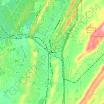
Name: Pelham topographic map, elevation, terrain.
Location: Pelham, Shelby County, Alabama, 35124, États-Unis d'Amérique (33.24567 -86.84999 33.32567 -86.76999)
Average elevation: 164 m
Minimum elevation: 74 m
Maximum elevation: 332 m