
Thank you for supporting this site ❤️
Make a donation
Make a donation
Gear up for your next adventure:
As an Amazon Associate, this site earns from qualifying purchases at no extra cost to you.
Bagrakote topographic map
Click on the map to display elevation.
Thank you for supporting this site ❤️
Make a donation
Make a donation
Gear up for your next adventure:
As an Amazon Associate, this site earns from qualifying purchases at no extra cost to you.
About this map
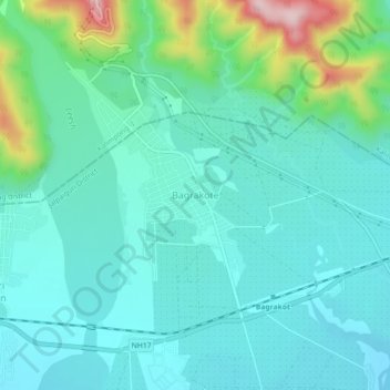
Name: Bagrakote topographic map, elevation, terrain.
Location: Bagrakote, Mal, Jalpaiguri District, West Bengal, India (26.86125 88.55674 26.90125 88.59674)
Average elevation: 212 m
Minimum elevation: 149 m
Maximum elevation: 462 m
Thank you for supporting this site ❤️
Make a donation
Make a donation
Gear up for your next adventure:
As an Amazon Associate, this site earns from qualifying purchases at no extra cost to you.