
Hochdorf topographic map
Interactive map
Click on the map to display elevation.
About this map
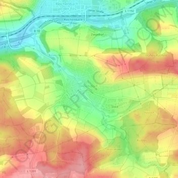
Name: Hochdorf topographic map, elevation, terrain.
Average elevation: 315 m
Minimum elevation: 255 m
Maximum elevation: 375 m
Other topographic maps
Click on a map to view its topography, its elevation and its terrain.
Unterensingen
Deutschland > Baden-Württemberg > Landkreis Esslingen
Unterensingen, Vereinbarte Verwaltungsgemeinschaft der Stadt Nürtingen, Landkreis Esslingen, Baden-Württemberg, 72669, Deutschland
Average elevation: 296 m