
Thank you for supporting this site ❤️
Make a donation
Make a donation
Gear up for your next adventure:
As an Amazon Associate, this site earns from qualifying purchases at no extra cost to you.
Bois-de-Lessines topographic map
Click on the map to display elevation.
Thank you for supporting this site ❤️
Make a donation
Make a donation
Gear up for your next adventure:
As an Amazon Associate, this site earns from qualifying purchases at no extra cost to you.
About this map
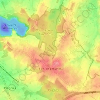
Name: Bois-de-Lessines topographic map, elevation, terrain.
Location: Bois-de-Lessines, Lessines, Ath, Hainaut, Wallonie, Belgique (50.68795 3.84927 50.71777 3.91346)
Average elevation: 41 m
Minimum elevation: -110 m
Maximum elevation: 76 m
Thank you for supporting this site ❤️
Make a donation
Make a donation
Gear up for your next adventure:
As an Amazon Associate, this site earns from qualifying purchases at no extra cost to you.