
Thank you for supporting this site ❤️
Make a donation
Make a donation
Gear up for your next adventure:
As an Amazon Associate, this site earns from qualifying purchases at no extra cost to you.
Rumford topographic map
Click on the map to display elevation.
Thank you for supporting this site ❤️
Make a donation
Make a donation
Gear up for your next adventure:
As an Amazon Associate, this site earns from qualifying purchases at no extra cost to you.
About this map
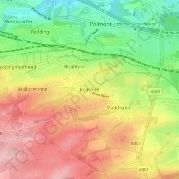
Name: Rumford topographic map, elevation, terrain.
Location: Rumford, Falkirk, Scotland, FK2 0SD, United Kingdom (55.95598 -3.73190 55.99598 -3.69190)
Average elevation: 104 m
Minimum elevation: 10 m
Maximum elevation: 201 m
Falkirk trails, hiking, mountain biking, running and outdoor activities
Thank you for supporting this site ❤️
Make a donation
Make a donation
Gear up for your next adventure:
As an Amazon Associate, this site earns from qualifying purchases at no extra cost to you.