Geolocate

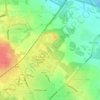
Abram topographic map

Click on the map to display elevation.

About this map

Name: Abram topographic map, elevation, terrain.

Location: Abram, Wigan, Greater Manchester, England, WN2 5RQ, United Kingdom (53.48867 -2.61524 53.52867 -2.57524)

Average elevation: 36 m

Minimum elevation: 17 m

Maximum elevation: 59 m

England trails, hiking, mountain biking, running and outdoor activities

Other topographic maps

Click on a map to view its topography, its elevation and its terrain.

Haigh

United Kingdom > England > Wigan > Haigh

Average elevation: 103 m

Lilford Woods

United Kingdom > England > Wigan > Howe Bridge > Lilford

Average elevation: 33 m

Three Sisters Lake

United Kingdom > England > Wigan > Bryn

Average elevation: 50 m

Gear up for your next adventure:

📐Altimeters & Barometers - Tools for measuring altitude and air pressure
🧥Breathable Waterproof Jackets - Essential rain protection for the unpredictable British climate
🎿Telescopic Trekking Poles - Reduces knee strain on steep topographic descents
🧣Neck Gaiters - Versatile protection against wind and cold
🍳Camping Stoves - Compact stoves for outdoor cooking

As an Amazon Associate, this site earns from qualifying purchases at no extra cost to you.