
Wahkiakum County topographic map
Interactive map
Click on the map to display elevation.
About this map
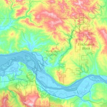
Name: Wahkiakum County topographic map, elevation, terrain.
Location: Wahkiakum County, Washington, United States (46.14463 -123.74008 46.38551 -123.21267)
Average elevation: 246 m
Minimum elevation: -3 m
Maximum elevation: 918 m
Other topographic maps
Click on a map to view its topography, its elevation and its terrain.
Rosburg
United States > Washington > Wahkiakum County
Rosburg, Wahkiakum County, Washington, 98643, United States
Average elevation: 51 m