
Thank you for supporting this site ❤️
Make a donation
Make a donation
Gear up for your next adventure:
As an Amazon Associate, this site earns from qualifying purchases at no extra cost to you.
Mabarangal'l topographic map
Click on the map to display elevation.
Thank you for supporting this site ❤️
Make a donation
Make a donation
Gear up for your next adventure:
As an Amazon Associate, this site earns from qualifying purchases at no extra cost to you.
About this map
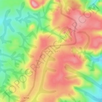
Name: Mabarangal'l topographic map, elevation, terrain.
Location: Mabarangal'l, Martap, Vina, Région de l'Adamaoua, Cameroun (6.97551 13.11311 7.01551 13.15311)
Average elevation: 1,152 m
Minimum elevation: 1,066 m
Maximum elevation: 1,224 m
Thank you for supporting this site ❤️
Make a donation
Make a donation
Gear up for your next adventure:
As an Amazon Associate, this site earns from qualifying purchases at no extra cost to you.