
Melgar topographic map
Interactive map
Click on the map to display elevation.
About this map
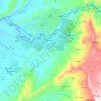
Name: Melgar topographic map, elevation, terrain.
Location: Melgar, Oriente, Tolima, 734001, Colombia (4.09569 -74.75214 4.27261 -74.55537)
Average elevation: 643 m
Minimum elevation: 267 m
Maximum elevation: 1,850 m