
El M'Ghair topographic map
Interactive map
Click on the map to display elevation.
About this map
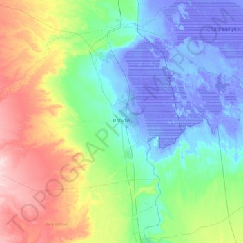
Name: El M'Ghair topographic map, elevation, terrain.
Location: El M'Ghair, El M'Ghair District, El M'Ghair, Algeria (33.81226 5.22888 34.07718 6.14675)
Average elevation: 48 m
Minimum elevation: -32 m
Maximum elevation: 222 m