
Boghni topographic map
Interactive map
Click on the map to display elevation.
About this map
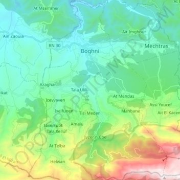
Name: Boghni topographic map, elevation, terrain.
Location: Boghni, Boghni District, Tizi Ouzou, 15003, Algeria (36.45643 3.92416 36.57371 4.01946)
Average elevation: 643 m
Minimum elevation: 180 m
Maximum elevation: 2,085 m