
Djendel topographic map
Interactive map
Click on the map to display elevation.
About this map
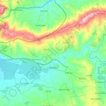
Name: Djendel topographic map, elevation, terrain.
Location: Djendel, Djendel District, Aïn Defla, Algeria (36.17505 2.31526 36.30923 2.52676)
Average elevation: 445 m
Minimum elevation: 280 m
Maximum elevation: 868 m