
Meftah topographic map
Interactive map
Click on the map to display elevation.
About this map
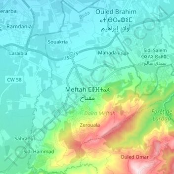
Name: Meftah topographic map, elevation, terrain.
Location: Meftah, Meftah District, Blida, Algeria (36.57445 3.18071 36.67259 3.30180)
Average elevation: 131 m
Minimum elevation: 18 m
Maximum elevation: 565 m