
Thank you for supporting this site ❤️
Make a donation
Make a donation
Gear up for your next adventure:
As an Amazon Associate, this site earns from qualifying purchases at no extra cost to you.
Las-ud topographic map
Click on the map to display elevation.
Thank you for supporting this site ❤️
Make a donation
Make a donation
Gear up for your next adventure:
As an Amazon Associate, this site earns from qualifying purchases at no extra cost to you.
About this map
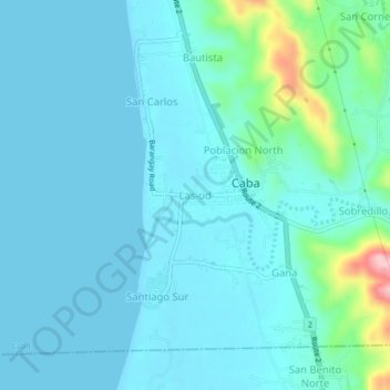
Name: Las-ud topographic map, elevation, terrain.
Location: Las-ud, Caba, La Union, Ilocos Region, 2502, Philippines (16.41057 120.32022 16.45057 120.36022)
Average elevation: 24 m
Minimum elevation: 0 m
Maximum elevation: 177 m
Thank you for supporting this site ❤️
Make a donation
Make a donation
Gear up for your next adventure:
As an Amazon Associate, this site earns from qualifying purchases at no extra cost to you.