
An Nhơn topographic map
Interactive map
Click on the map to display elevation.
About this map
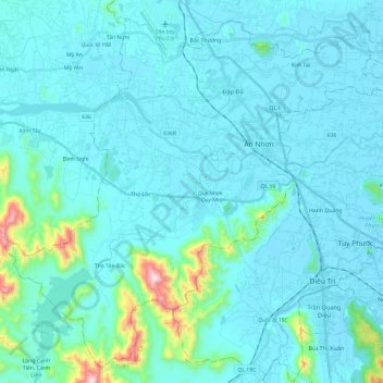
Name: An Nhơn topographic map, elevation, terrain.
Location: An Nhơn, Bình Định Province, Vietnam (13.75257 108.95048 13.96330 109.18785)
Average elevation: 61 m
Minimum elevation: -1 m
Maximum elevation: 632 m
Other topographic maps
Click on a map to view its topography, its elevation and its terrain.