
Thuận Đạo topographic map
Interactive map
Click on the map to display elevation.
About this map
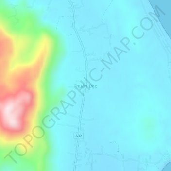
Name: Thuận Đạo topographic map, elevation, terrain.
Location: Thuận Đạo, Phù Mỹ District, Bình Định Province, Vietnam (14.22701 109.14544 14.26701 109.18544)
Average elevation: 84 m
Minimum elevation: 0 m
Maximum elevation: 460 m