Geolocate

Maidencombe topographic map

Click on the map to display elevation.

About this map

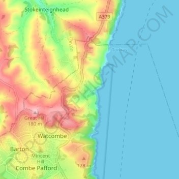
Name: Maidencombe topographic map, elevation, terrain.

Location: Maidencombe, Torbay, England, TQ1 4SU, United Kingdom (50.48655 -3.53603 50.52655 -3.49603)

Average elevation: 57 m

Minimum elevation: -2 m

Maximum elevation: 178 m

Torbay trails, hiking, mountain biking, running and outdoor activities

Other topographic maps

Click on a map to view its topography, its elevation and its terrain.

Brixham

United Kingdom > England > Torbay

Average elevation: 38 m

Gear up for your next adventure:

🥄Titanium Camping Sporks - The ultimate lightweight utensil for trail meals
🥼Base Layers - Thermal base layers for temperature regulation
🚶Walking Pedometers - Simple distance tracking for casual trail walkers
Lightweight Tents - Compact tents for backpacking and trekking
🧷Tenacious Repair Tape - Instant fix for torn tents, jackets, or dry bags

As an Amazon Associate, this site earns from qualifying purchases at no extra cost to you.