Geolocate

Picture Rocks topographic map

Click on the map to display elevation.

About this map

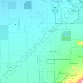
Name: Picture Rocks topographic map, elevation, terrain.

Location: Picture Rocks, Pima County, Arizona, United States (32.29157 -111.32133 32.40249 -111.13740)

Average elevation: 658 m

Minimum elevation: 591 m

Maximum elevation: 1,324 m

Gear up for your next adventure:

🐕Dog Hiking Gear - Equipment for hiking safely with dogs
🔋Solar Power Banks - Keep your GPS and phone charged during multi-day expeditions
🪢Paracord - Multi-purpose cord for camping and survival
🧭Professional Hiking Compasses - High-precision liquid-filled compasses for map reading and orientation
📍Handheld GPS Navigators - Reliable satellite navigation for hiking and off-road exploration

As an Amazon Associate, this site earns from qualifying purchases at no extra cost to you.