
Brenaygletscher topographic map
Interactive map
Click on the map to display elevation.
About this map
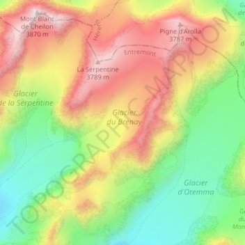
Name: Brenaygletscher topographic map, elevation, terrain.
Location: Brenaygletscher, Bagnes, Entremont, Wallis, 1934, Schweiz (45.95435 7.39002 45.99188 7.45489)
Average elevation: 3,250 m
Minimum elevation: 2,761 m
Maximum elevation: 3,848 m