
Craigendarroch topographic map
Interactive map
Click on the map to display elevation.
About this map
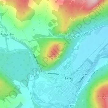
Name: Craigendarroch topographic map, elevation, terrain.
Average elevation: 256 m
Minimum elevation: 188 m
Maximum elevation: 443 m
Other topographic maps
Click on a map to view its topography, its elevation and its terrain.
Balmoral Castle
United Kingdom > Scotland > Aberdeenshire > Ballater
Balmoral Castle, Riverside walk, Newton, Ballater, Aberdeenshire, Scotland, AB35 5TB, United Kingdom
Average elevation: 342 m